The reason why getting astride a motorcycle is meditation - Spiti Travelogue
From my teenage years I have always wondered how much fun it would be to ride a
From my teenage years I have always wondered how much fun it would be to ride a motorcycle on a set of twisties. I always wanted to do so someday. The motto was to live life on the edge. As days passed, I came across a few riders of my hometown and fruitful things such as bike rides, long chit chat sessions started. I had never dreamt of riding beyond Shimla, the magical places beyond it were unknown to me. One day in 2011, I came to know that my fellow riders were planning to ride to the Mecca of riders (Leh). However, asking them about joining the ride was not less than stupidity as I was a beginner. Somehow, I gathered all my strength and managed to ask them about it. Luckily, they agreed and at that moment, the kid in me understood that riding is my love and passion.
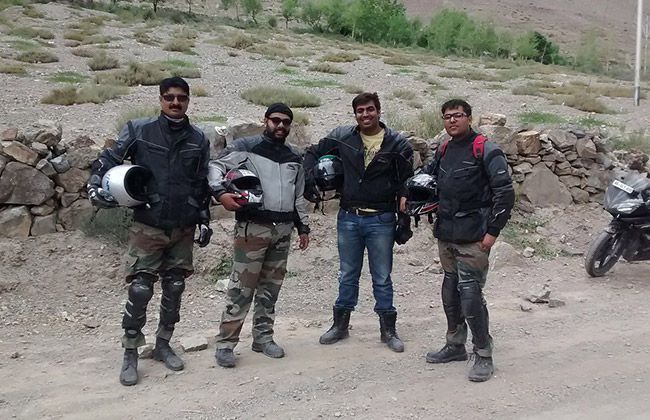
Almost after 4 years, on a lazy Sunday, I was getting bored and was dreaming about getting back to the real life. Here real life means a life full of riding which had totally vanished from my life. I happened to get a message from a fellow rider, Lovish, asking me about a possible Spiti ride. The moment I saw his message, I thought “Finally the day has come”, because the Spiti circuit was in my ‘to do’ list since a long time. I was a bit nervous, a little hopeful and super excited about the adventure lying ahead of me.
Panchkula, roughly 250km from Delhi via Ambala, was our base and I reached there a day before the ride. The eagerness to hit the hills early in the morning overcharged us but we managed to sleep only for a few hours
Day 1- Panchkula to Reckong Peo
Distance covered: 376km
Starting elevation: 365 M
Ending elevation: 2670 M
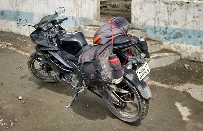
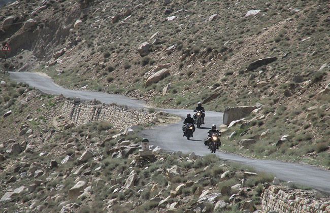
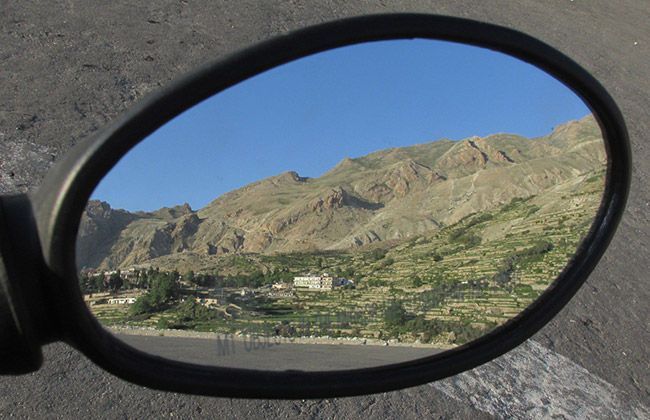
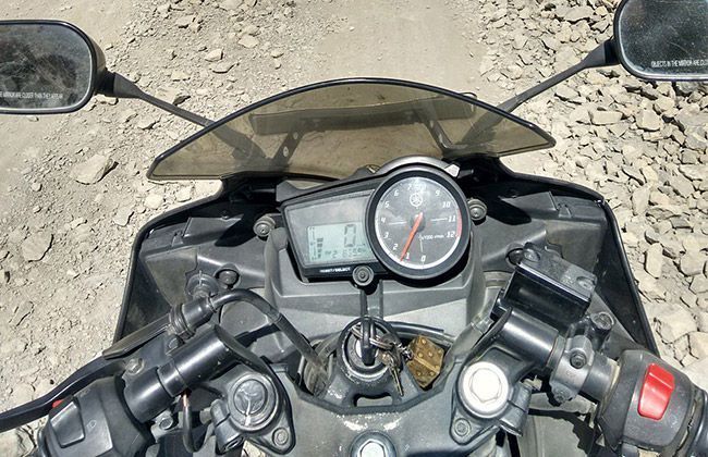
Alarms rang and we both (Lovish and me) were up immediately. We called our third rider, Deven, who was supposed to meet us at Panchkula toll. We got ready and soon the mean machines (Yamaha R15 and Pulsar 150) were rolling to catch up the third rider. After meeting Deven at the toll, we started for our first pit stop Kandaghat which was 70 km away where Siddharth (a rider from Kandaghat) was supposed to join us. The first glimpse of hills made all three of us mad and we reached Kandaghat pretty soon. The first day of the ride was not that thrilling as we were still in the concrete jungle and had to cross Shimla, Narkanda and many more places. After Rampur, a little taste of the ride which we were going to experience during next 8 days started and from roads to no roads, we moved on with joy to our first day destination, Reckong Peo. After a brief chat, we all went to our rooms and dozed off for the night.
Day 2- Reckong Peo to Nako
Distance covered: 103 Km
Starting elevation: 2670 M
Ending elevation: 3663 M
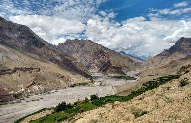
When we woke up, the first view of the mesmerizing snow-capped mountain range boosted us and the overdoze of excitement to reach Spiti (land of the Gods, barren lands, unseen adventure and Buddhism) embraced us. Believe me, the tranquillity of the place and the scenic beauty made us sit and admire it from our balcony for good 45 minutes. With all the zest and zeal, we saddled up our motorcycles for an exhilarating journey. Ditching our routine life seemed so peaceful at the moment, and the natural painting-like beauty that surrounded us was the icing on the cake. Taking the up's and down's of the so called roads, we reached Nako. Soon after settling our stuff in hotel rooms, we went to helipad for a photo session. The night was so silent and the sky was so beautiful in Nako (thanks to its 4000m height) that after a few attempts, Lovish and Sid got clear shots of the sky. 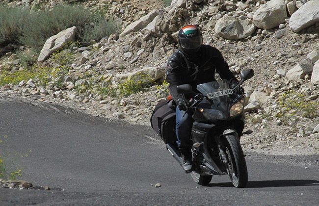
Day 3- Nako to Tabo
Distance covered: 80 Km
Starting elevation: 3663 M
Ending elevation: 3050 M
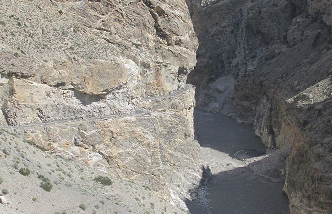
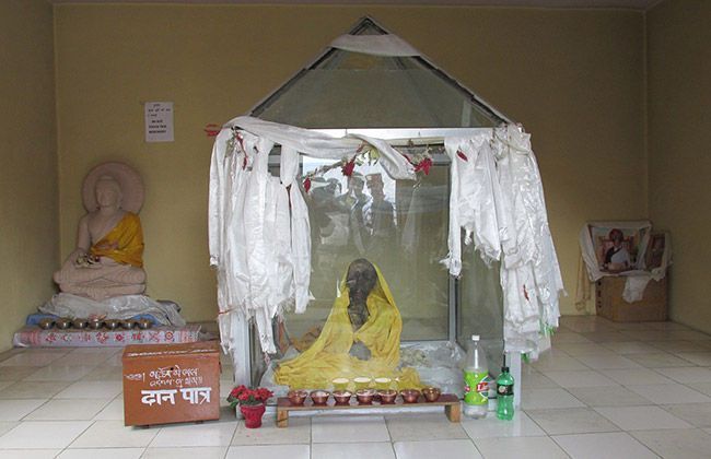
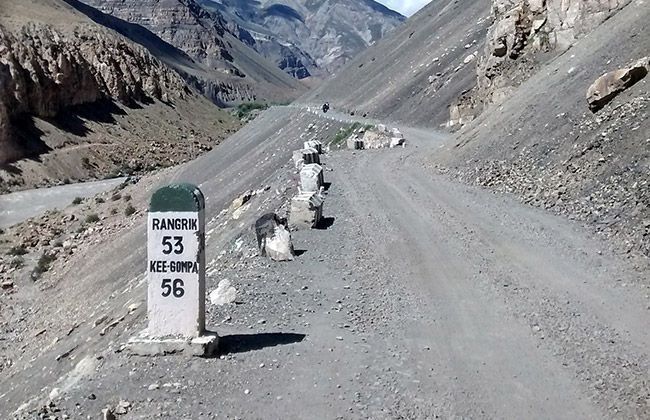
As we had got acclimatised to the climate at the upper reaches of the hills very well, starting out for the days' ride was easy. Soon, I realized that I was going to be in big trouble because the fuel-guage of my Yamaha R15 was low and the next fuel station was in Kaza, which was at least 100 km away. After enquiring with some of the locals, we got to know that shopkeepers sell petrol and diesel in these areas which are far away from petrol pumps. After refiling the tank and stocking extra fuel for my steed we throttled our bikes. The first 34 km till Sumdo helped us in digesting the heavy breakfast. At the Sumdo check post, we enquired officers posted at that check post about Kaurik but the stern “NO” from officials saddened our faces. China was just 17 km away and we could not make it because of the permissions. Nevertheless, another iconic place was on our list, Giu temple.
The mummy of a Chinese monk placed in the temple is expected to be about 10,000 years old. Till Giu, we had gone over enough bad roads to become habituated with them. Soon after, it became clear that it was going to rain heavily in the valley, and everybody on the road was advised to postpone their plans for the day. We decided to take a risk and ride on though. On our way to Tabo, we tasted the first drop of rain and all of a sudden all of our bikes were enjoying the off road tarmac. There was a big possibility of the route becoming worse or any of us falling thanks to the off road road, but we were enjoying the experience too much to care. We stopped at Tabo to have some food. The unexpected delicious food put all of us in dilemma whether to ride further or to stay. Deliberately, the final decision was to stay. The calm peace of night took over the silence of day and we slept listening to some good music.
Day 4- Tabo to Kaza
Distance covered: 35 Km
Starting elevation: 3050 M
Ending elevation: 3050 M
The way we started our ride was so energetic that it seemed like we would complete the rest of the journey on the same day, but god had decided something else for us. On our way to Kaza, bystanders informed us about the landslide some 6-7 km before Sichling. We thought, it was like the other normal landslides and did not pay much attention to the problem ahead. When we reached the point, we found that we were so small in front of the power of almighty. As the route was the landslide prone area, we had to ride back for some 10 km to find a shelter till BRO people cleared the debris on the road. An abandoned building became our abode for the next six hours. We were in no hurry and got leisure time to spend at our “kothi”. We wanted to ride ahead, but it was getting dark and continuing the ride would have been dangerous. We decided to return to Tabo for the night and were lucky enough to find rooms; soon after the town was swarmed by other tourists who were forced to come back due to landslides en route to Sumdo.
Day 5- Tabo to Kaza, again!
Distance covered: 70 Km
Starting elevation: 3050 M
Ending elevation: 3740 M
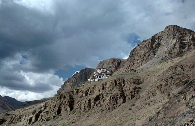
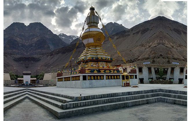
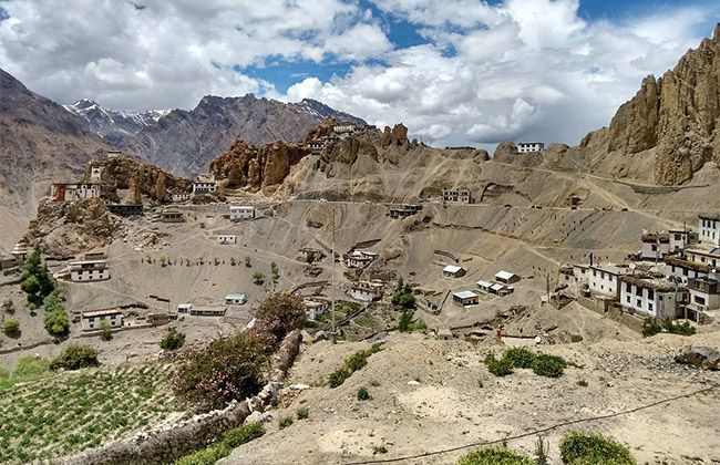
Because of shortage of time, we had to alter our route map and decided to ditch Demul village. We all were in no mood to leave Pin valley but left the decision on the weather condition. At 11 in the morning, we got information that the route has been opened and is feasible to ride on. We started our ride again and all of us were enjoying the sharp narrow roads. Dhankar Monastery was still on the cards. We rode to the Dhankar Monastery and I got answers for why the Buddhist Gompa's are located deep in the Himalayan mountains, carved out on the sheer cliff faces, near alluring rivers and lakes. “There is a hidden purpose behind these because this is the perfect way to turn our mind away from the distractions of the outer world and focus on discovering the profound truth of the inner world,” I had read somewhere. We reached down to the main road and soon a sign board appeared showing the way to Mud village which is the last village of India in Pin valley. The Gods decided to make our ride interesting again and it started raining. Our plan to visit Pin Valley was cancelled for the same reason and we rode to Kaza all drenched.
Kaza petrol pump is the world's highest retail outlet, situated at 12,270 ft. Following a long food session, Lovish, Sid and Deven decided to explore the town and as I was feeling a bit low, I decided to go back to hotel and take some rest. At 7:15 pm, Sid knocked at my door and asked me to come out. He informed me that a few minutes ago a cloud bursted in Langza and a small nullah just below our hotel has turned up into an uncontrolled water way. There was no light, so I could not see the exact water level but could hear the loud noise of water hitting the stones. Sid showed me a video of water covering the area and I was shocked. The video reminded us of the calamity of Kedarnath. The hotel owner told us there is nothing to worry about as there is a tradition in the valley from the past many years that whenever Lama Ji visit that place, it rains to make that place pure. We respected their beliefs and went for dinner.
Day 6- Kaza to Komic to Kibber
Distance covered: 110 Km
Starting elevation: 3740 M (peak of the day - 4587 M)
Ending elevation: 3740
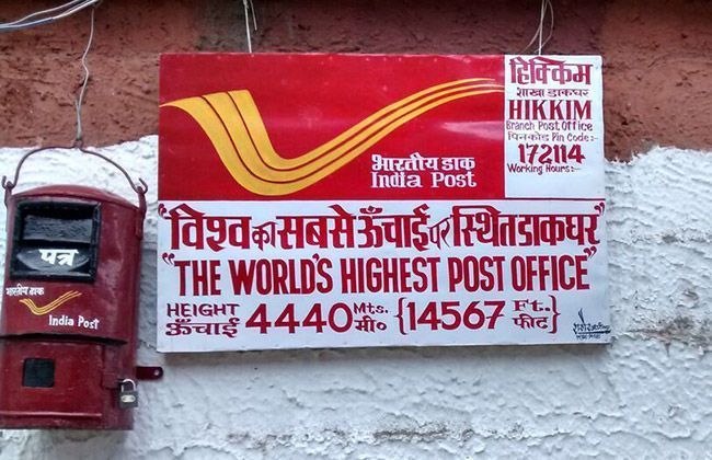
The next day, we packed our bags and after munching on heavy pranthas we started riding to capture some more unforgettable moments at the world's highest village, Komic, and at the world's highest post office at Hikkim. Local cab drivers informed us that because of the cloud burst, roads to the highest village and the post office have been blocked and we can't go there. To witness the soothing beauty of the Langza village, we again throttled our steeds. The splendid views of the small village took us to some other world and it was not less than God's own land. The roads seemed good, unlike what was told to us earlier, and we decided to carry on riding. A little further we found out that the roads had been cleared, and decided to go on to Komic village.
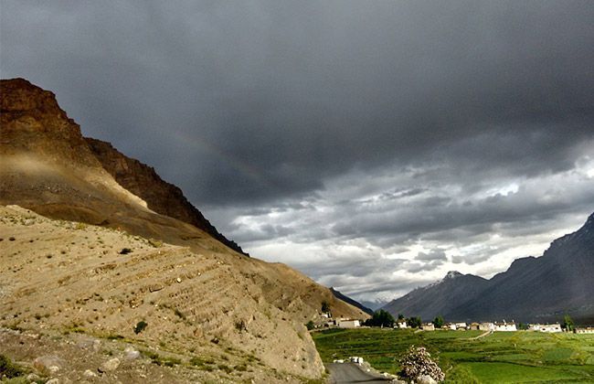
We asked about the highest post office and got to know it is in Hikkim, 4 km on the way back. There was no reason to wait and we headed back to Hikkim. All three guys except me went to post a postcard to their loved ones and I decided to soak in the atmosphere. Letters posted, it was time to come back to Kaza and take the road to Kibber village. On our way to Kibber, dancing Lamas in the Key monastery left me and Deven speechless. It took us 20 minutes to reach to Kibber but as soon as we reached up there, it started snowing. We were really happy at first, it slowly dawned on us that if it snowed for longer we would surely get stuck there for a long time. We waited for about half-an-hour and thankfully, the snowing subdued; we headed back to Kaza. While coming downhill, I witnessed the best rainbow I have ever seen in my life. The sun rays crossing through the black clouds all over us and falling on the Key monastery created a paramount view. Suddenly, it started raining and we reached Kaza all drenched. We found a cozy stay and food for the night.
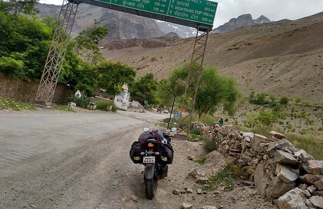
Day 7- Kaza- to Batal-
Distance covered: 90 km
Starting elevation: 3740 M
Ending elevation: 3960 M
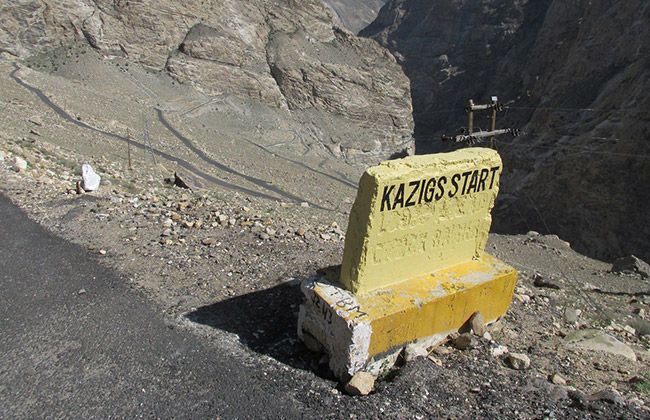
The last two days of our ride were going to be the toughest and all of us knew this because of the bad road condition, in fact at many places there were no roads at all. We also had to cross one of the two passes of our ride and that too in the rain. The thought made us motivated and soon we were on the broken patches of 'road' to Kunzam pass. The Kunzam pass had been cleared and declared open for vehicles few days before we started our ride, which meant that there would be a lot of snow around. The Chandertal lake was the final destination on the days' trip, it was about 20 km from the pass. It took us almost an hour to cover 10 km, the route was treacherous; the melting snow was slippery and mucky, the road as riddled with potholes, there were loose pebbles everywhere etc. The worsening weather and an overflowing nullah finally forced us to turn our backs.
With a heavy heart, we decided to abandon the trip to Chandertal and head to Batal instead. The small settlement has a rest-house, which is the only pukka building there. You will find that apart from the rest-house this place has a few tents which belong to the dhaba-walas. We decided to stay at the rest-house for the night, the blowing winds made the night eerie. We decided to leave Batal early in the morning the next day.
Day 8- Batal to Manali-
Distance covered: 118 km
Starting elevation: 3960 M
Ending elevation: 2050 M
Though the distance between Batal and Manali was just 120 km, terrible road-conditions, innumerable water crossings and the constant rain affected our speed. The slush in the Rohtang made us reminisce about our Leh ride. The brakes on all of our bikes were affected by the slush and we had to heavily depend on engine braking to get us down to Manali. We enjoyed our time in Manali, I recommend you visit the 1947 Cafe in Old Manali; the food and ambience are really amazing.
Day 9- Manali to Chandigarh-
Distance covered: 330 Km
Starting elevation: 2050 M
Ending elevation: 365 M
Wherever you go, the fun of going back home is unbeatable. We felt elated, we had completed a long ride on roads less travelled; at the same time, we were brought back to earth thanks to congested traffic from Kullu till Kiratpur. As I reached Chandigarh, I realised: I am now Spitified!